Cedar Hills Utah Facts
Facts About Cedar Hills Utah
Schools
in Cedar Hills Utah
Facts
About Cedar Hills Utah
Information
About Cedar Hills Utah
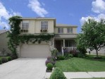
SOLD
Statistics About Cedar Hills Utah
Bank Foreclosures and Short Sales in
Cedar Hills
Cedar Hills Utah Facts: Geography of Cedar
Hills Utah
The population of Cedar Hills is
approximately 10,179 (2015). The amount of land area
in Cedar Hills is 4.146 sq. kilometers. The amount
of surface water is 0 sq kilometers. Cedar Hills is
positioned 40.40 degrees north of the equator and
111.75 degrees west of the prime meridian. State
Rank by Population: 106. Out of the 877 registered
voters, 740 cast ballots in the 2000 November
election. Cedar Hills median income is $39,018
(1989). Another Cedar Hills Utah Fact: Cedar Hills location in Utah County
is about 30 minutes south
of Salt Lake, near Pleasant Grove and Alpine.
Cedar Hills Utah Facts: Demographics of
Cedar Hills
Utah
The climate for Cedar Hills is Moderate. There are
approximately 10 to 20 inches of snow each year with much
more in the mountain areas. Cedar Hills average annual rainfall is 16 inches per year Cedar Hills average temperature is (January) 21 (July) 83
degrees F.
Cedar Hills Utah Facts: History of Cedar
Hills Utah
Cedar Hills history: Once part of the shoreline of
ancient Lake Bonneville, Cedar Hills sits on a bench
or alluvial fan created by the changing and receding
lake. It was called such because of the many cedar
trees which grew there. Because of its location high
on the hillside, the view of the surrounding area,
including Utah Lake, is commanding. Cedar Hills is
one of the new communities in Utah County, being
established as a community in 1977. It is near
Pleasant Grove and Alpine. The area was not used
extensively by the local Indian Tribes because of
the dryness of the bench, but some artifacts have
been found in recent years. In the mid-1800’s, the
early settlers of the area used the bench mostly for
the grazing of livestock.
Cedar Hills Utah Facts: Political Party
According to voter data, Cedar Hills, UT votes 77%
Republican. 20% of the people of Cedar Hills Utah voted Democrat
and 3% of Cedar Hills Utah voted for an independent. Out of the
3,671 registered voters, 2,941 cast ballots in the 2000
November election.
Cedar Hills Compared to Utah
State Average
* Median house value above state average.
* Median age significantly below state average.
* Renting percentage significantly below state
average.
* Length of stay since moving in significantly below
state average.
* Number of rooms per house above state average.
* House age significantly below state average.
For Population 15 Years and
Over in Cedar Hills Towns
* Never married: 23.1%
* Now married: 72.7%
* Separated: 0.3%
* Widowed: 0.7%
* Divorced: 3.2%
Search Cedar Hills Utah Homes for Sale
Search homes for sale in Cedar Hills Utah. Find
Bank Foreclosures and Short Sales for Sale in Cedar Hills Utah.
Hire a local Cedar Hills Utah Realtor.