Saratoga Springs Utah Facts
Facts About Saratoga Springs Utah
Schools
in Saratoga Springs Utah
SOLD
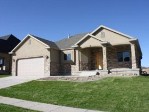
Homes in Saratoga Springs Utah
Facts
About Saratoga Springs Utah
Information
About Saratoga Springs Utah
Bank Foreclosures and Short Sales in
Saratoga Springs
Saratoga Springs Utah Facts: Statistics and
Facts
Here are some Saratoga Springs Utah Facts:
The population of Saratoga Springs is
approximately
175 (1997). The population rose to 22,749 in 2015. This is
one of the fastest growing cities in Utah County. Saratoga Springs is positioned 40.40 degrees
north of the equator and 111.85 degrees west of the prime
meridian.
Saratoga Springs Utah Facts: Geography
Saratoga Springs location: near Lehi and the "point of the
mountain" in northern Utah County. Saratoga Springs is
near the northern shore of Utah Lake.
Saratoga Springs Utah Facts: History of
Saratoga Springs Utah
Saratoga Springs is the oldest resort on Utah Lake and was
named for the New York resort, Saratoga. It opened on 24
July 1884. It’s fame is from the hot springs which keeps a
comfortable year-round temperature.
John Beck, from Germany, called his land here Beck’s
Saratoga Springs. By 1914, it had changed owners several
times. At this time it was purchased by the Austin Brothers
and Austin and Sons Sheep Companies. They planed to
subdivide the area into farms and city lots. The city never
really took off and more new owners took over from time to
time. In 1950, major improvements were made to the resort to
increase the comfort levels. In 1968, a disastrous fire
destroyed much of the resort, but the owners rebounded and
opened for the season anyway. In the spring of 1968,
Saratoga lovers were shocked by a $100,000 fire at the
resort. Lost in the fire was the main building that housed
the indoor pool, dressing rooms, laundry, ticket office,
snack bar and gift redemption center. The resort operator
quickly had the debris removed, and the resort was ready for
its Memorial Day opening three weeks later. Saratoga Springs
was incorporated as the 23rd city in Utah County. The
incorporation date of Saratoga Springs: 1997, December 30.
Saratoga Springs Utah Facts: Climate and
Weather
The climate for Saratoga Springs is Moderate. There are
approximately 10 to 20 inches of snow each year.
Saratoga Springs average annual rainfall is 16 inches per
year Saratoga Springs average annual precipitation is 21.38
inches per year. Saratoga Springs average temperature
is 52.3
degrees F.
Saratoga Springs Utah Facts: Demographics
There were 271 households out of which 57.6% had
children under the age of 18 living with them, 84.1%
were married couples living together, 4.4% had a
female householder with no husband present, and 8.1%
were non-families. 6.3% of all households were made
up of individuals and 1.8% had someone living alone
who was 65 years of age or older. The average
household size was 3.70 and the average family size
was 3.88.
In the town the population was spread out with
38.3% under the age of 18, 10.2% from 18 to 24,
32.9% from 25 to 44, 14.9% from 45 to 64, and 3.8%
who were 65 years of age or older. The median age
was 26 years. For every 100 females there were 101.4
males. For every 100 females age 18 and over, there
were 99.7 males.
The median income for a household in the town was
$62,212, and the median income for a family was
$61,923. Males had a median income of $44,464 versus
$36,739 for females. The per capita income for the
town was $20,304. About 3.8% of families and 2.5% of
the population were below the poverty line,
including 2.7% of those under age 18 and 17.4% of
those age 65 or over.
Search Saratoga Springs Utah Homes for Sale
Search homes for sale in Saratoga Springs Utah. Find
Bank Foreclosures and Short Sales for Sale in Saratoga
Springs Utah.
Hire a local Saratoga Springs Utah Realtor.

Saratoga Springs Utah Bank Foreclosures